GIS and Remote Sensing
Geospatial analysis, including Geographic Information Systems (GIS) and remote sensing technology, can enhance planning and decision-making by allowing spatial analysis and visual representation of project boundaries and potential impacts. Spatial presentation of environmental and social monitoring data can also support adaptive management and the development of more efficient an effective environmental and social management programs.
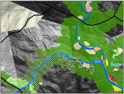
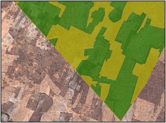
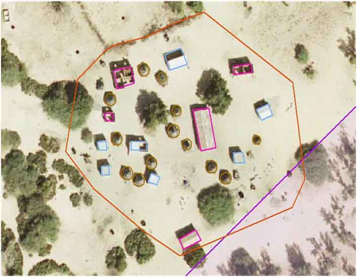
Geospatial analysis provides a powerful tool to assess land cover types over large areas, and can make field surveying more efficient. It can also be used to gain an understanding of historical changes in land cover and assets, to obtain a snapshot of current environmental and social conditions and to predict future changes. As a specialist environmental consulting company operating since 1993, Earth Systems has developed specialist capabilities in the use of GIS mapping and remote sensing technologies for land use and forest mapping.
Earth Systems staff members are able to work with a range of data formats, including high-resolution satellite imagery and aerial photography, and are familiar with a number of commonly used GIS software packages.
Services Provided
 Forest and land use mapping
- Detailed land and asset baseline mapping
- Quantification of land use change / impact
- Development of geodatabases
- Catchment modelling and flood level overlay mapping
- Spatial visualisation of environmental and social impact analysis from various Project types (e.g. mining, hydropower)
- Procurement and processing of high resolution satellite imagery (eg. Worldview-2, IKONOS, Spot, Quickbird, GeoEye)
- Climate change vulnerability mapping
- 3D geospatial visualisation
Representative Experience
 Some examples of recent projects include:
- Spatial analysis of satellite imagery for social and environmental mapping and impact assessment as part of the Nam Theun II Project, Lao PDR
- Baseline environmental mapping for the Anthony Molybdenum Project, Australia
- Detailed land and asset baseline for the Grande Côte Mineral Sands Project, Senegal
- Biodiversity and Forest Use Study for the Ban Houayxai Gold-Silver Project, Lao PDR
- Mapping the spatial distribution of sulfidic material associated with acid sulfate soils in the Lower Murray Lakes, South Australia
- Compilation and production of The Water Map of Melbourne, 2004. This Smart Water Funded project is an important educational resource regarding water use in an urban environment
- Compilation and production of The Australian Water Map, 2003. This project has received praise and positive feedback from government, industry and education sectors
- Compilation and production of the World Environment Map (2002) and the Environment Map of Australia (2000). The maps identify environmental trends, achievements and issues. Earth Systems completed all stages of their production, from the original concept to the printing.
- Compilation and interpretation of the United Nations Tumen River Strategic Action Program environmental data sets into an Environmental Atlas
Please contact Earth Systems for more information or to discuss our range of Geospatial analysis services at enviro@competitiveedge.com.au/earth.