Non-Invasive Subsurface Mapping
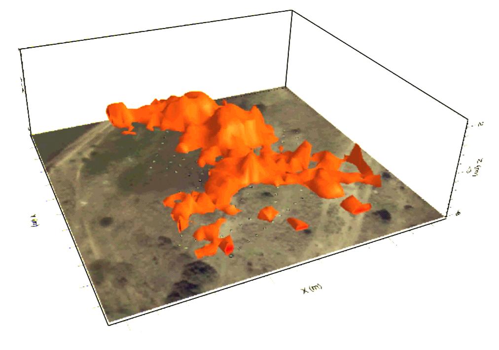
3D Image of braided fluvial system (orange) where contaminant plume is concentrated, as superimposed over an aerial photograph of the site.
Earth Systems’ uses cutting-edge non-Invasive geophysical mapping techniques to determine sub-surface characterise of sites without drilling or excavation. Geophysical mapping allows coverage of large areas in just a few days, and results in more efficient drilling, excavation and remediation programs through improved targeting of sub-surface resources. We can design and implement a detailed geophysical program, including processing and interpretation of data and preparation of reports and management plans to address site issues.
Earth Systems geophysical mapping techniques can potentially allow differentiation between zones horizontally and vertically, delivering cross-sections, 2D maps at desired depths or 3D images.
Services Provided
- Subsurface geological mapping;
- Aquifer identification and delineation;
- Groundwater quality mapping;
- Contaminated site assessment; and
- Identification and mapping of leaks from dams, tanks or channels.
Representative Experience
Earth Systems has recent experience in non-invasive subsurface mapping throughout Australia, including:
- Characterisation of aquifer system at a power station to establish connectivity between aquifers and saline seeps.
- Identification of sulphate distribution at an abandoned mine in South Australia.
- Identification of water accumulation within mine wastes to assess geotechnical stability and develop remediation actions.
- Characterisation of potential pollutant migration paths from a landfill to prevent potential contamination of Ramsar wetlands.
- Characterisation of pollutant plumes at an industrial site to assess suitability of remediation actions.
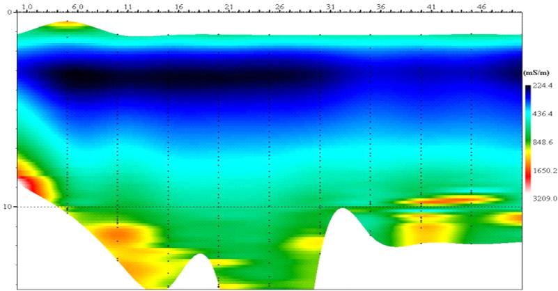
Cross-section of pollutant plume (dark blue) in sand channels incised by clay lenses
For more information please contact Earth Systems at water@competitiveedge.com.au/earth